Cambodia |
Cambodia Tours & Cambodia Tour Packages |
This section covers many valuable resources on Cambodia such as the travel guides or tips to travelers. Some of the topics contain links to the other related sites of similar subjects. In certain topic, we include lists of useful contacting address for your information.
Cambodia Fact File:
Country Name: The Kingdom of Cambodia
Country Name in Khmer language: Kampuchea
Motto: Nation - Religion – King
Capital City: Phnom Penh
Language: Khmer (Cambodian). Some English, French.
Government: Multy-party democracy under a constitutional monarchy
Important/Major Cities: Siem Reap (Gateway to the temples of Angkor). Sihanoukville (port and beach town). Battambang, Kampong Cham.
Major Rivers/Lakes: Tonle Sap River, Mekong River, Bassac River, Tonle Sap Lake
Ethnic Groups: Khmer (90-95%), ethnic-Chinese, Cham, ethnic-Vietnamese, several ethnic-minorities in the northeast.
Boring Countries: Thailand, Laos, Vietnam
International Airports: Phnom Penh (PHN), Siem Reap (SEP)
Religion: Theravada Buddhism (95%), Islam, Christianity, Animism.
Population of Cambodia: 14.2 million (est.)
Land area of Cambodia: 181.035 km2
Land area of Siem Reap: 10.299 km2
Currency: Riel (US$1=4200R). US dollars are as commonly used as riel
Voltage: 220v/50Hz
Time: GMT +7 hours
Country Calling Code: 855
Internet LTD: kh
Business Hours: 7:30-11:30 / 2:00-5:00 Closed Saturday afternoon and Sunday.
A sparsely populated province, it is renowned for its unique natural beauty and wealth of natural resources. The physical and environmental characteristic of the province forms an impressive range including undulating hills and mountains, a level plateau, watershed lowlands, crater lakes, rivers and waterfalls. Forest cover varies from area to area, from the dense impenetrable forest in the northern reaches, which are still rich in wildlife, to the drier and sparser forest, found in the southwest. Similarly, the soil types present range from rich volcanic soil to the sandy soil found near rivers.
 YEAK LOAM LAKE
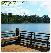
Yeak Loam Lake is situated 5 km south - east of Banlung (capital city of Ratanak Kiri). The Yeak Loam lake (volcanic crater) is the most beautiful lake of Ratanakiri formed by a volcanic eruption almost 4,000 years ago with 50m deep, 800m diameter and a walking path around the lake of 2,500 m. Two hundred meters of the track is a quaint wooden building housing tribal handicraft, the Crafts Museum.
 KACHANG & KATIENG WATERFALL
Kachang Waterfall is situated 6km north - west of Banlung. This Waterfall is located in the Kontung stream and flows into the Sre Pok River. The height of it is 12m and the water flows and falls throughout the year.A beautiful or magnificent landscape and huge amounts of fresh mist surround the waterfall. The visitors can take a bath and sit to look at the waterfall and other natural scenic beauties.
OU'SENSRANOH & OU' SEAN LAIR WATERFALL
Ou'Sensranoh Waterfall is situated 9 km south of Banlung. The height of it is 18m and the water flows and falls all the time. The visitors can go there rest and enjoy the fresh air, or to see the forest and listen to the birds ' cries. Ou'Sean Lair Waterfall is situated 26 km, South of Banlung. This Waterfall has 4 floors and the height of each floor is 4m The water flows throughout the year. Around the Waterfall are beautiful natural landscapes and the visitors can go take a bath if they wish.
CHA UNG WATERFALL
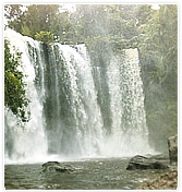
Cha Ung Waterfall is situated 8 km west of Banlung and it flows throughout the year. The source of water creating this Waterfall flowed from Eisey Patamak Mountain ( Svay Mountain ) . Below this Waterfall is a big hole, visitors can stand or sit to watch the waterfall from behind, and inhale he cool fresh air stemming from it.
 LUMPHAT WILDLIFE SANCTUARY
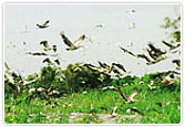
Lumphat Wildlife Sanctuary is situated 37km south of Banlung. With a total land area of 250,000 ha there are special kinds of animals and birds like tigers, elephants, red-headed vultures.
NOMG KABAT FOREST
Norng Kabat Forest is situated 23 km north of Banlung. This place has a pond. the visitors can go there to see the animals and birds which comes to at the pond . Beside this the tourists can go visit the ethnic villages, ethnic culture (tradition belief, festival, dancing, music).
VIRACHAY NATIONAL PARK
Virachay National Park is situated 45 km north of Banlung. With a total land area of 332,500 ha. It has varieties of plants and trees in the forest and many different kinds of animals and birds.